PRESENTATION
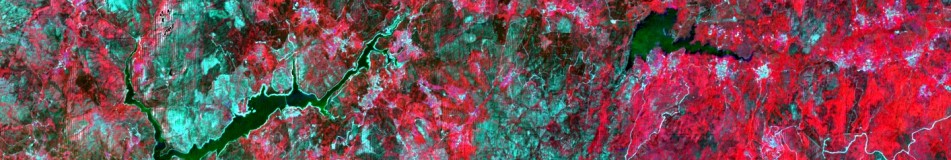
Remote sensing and geographic information systems (GIS) have been widely used in recent decades which have provided a global, regional and local perspective. Images obtained by geostationary orbit satellites such as METEOSAT have generated useful clearly information at global and continental scale. From the 70’s, remote sensors such as MSS, TM and ETM +, aboard the Landsat 7 satellite platform provide a spatial coverage, temporal and spectral suitable for application in monitoring and land cover change analysis, multitemporal studies, mapping of fires, etc. New trading platforms such as IKONOS or Quickbird (with sub-meter spatial resolution) allow addressing urban and territorial planning from an absolutely new perspective. All this information, together with the ever more widespread and accessible geographic information techniques, offers opportunities that society should not miss. From Geostat Consulting we offer consulting assistance with scientific-technical guidance based on GIS and earth observation techniques as support for public and private sector centres and institutions, small and medium companies. With a clear environmental guidance Geostat Consulting will provide not only advice to purely technical issues but also a more global perspective from an environmental approach.
GEOSERVICES
PREPROCESSING:
 1. Geometric correction and rectification of satellite images and aerial photography: 1.1. Methods based on physical (equations of collinearity, orbital models), semi-empirical (polynomial corrections with and without relief, models of rational functions, Delaunay triangulation) and mixed models. 1.2. Ground Control Points (GCP), test points, tie points. 1.3. Colour, radiometric and geometric considerations into image resampling: nearest neighbour, bilinear and bicubic interpolation. 1.4. Considerations on the size of the output pixel. 1.5. Estimated error of the geometric correction. Statistical interpretation of RMS.
2.Mosaicking: Obtaining a homogeneous and continuous coverage of different scenes captured by the same sensor.
3.Projection changes: re-projection or change of reference system (UTM, geometric, WGS84, ED50, ETRS89, Zone 31, 30, 29, etc.). Both raster and vector formats.
4. Adjustment and image enhancement: 4.1. Reduction of image noise. 4.2. Highlighting fine details. 4.3. Detecting edges and contours. 4.4. Techniques: smoothing filters (low pass and median filters), enhancers filters, differential filters (Roberts, Sobel, Laplacian), directional filters.
5. Correction and radiometric calibration of satellite images: 5.1. Conversion of DN to radiance. 5.2. Correction of effects caused by the atmosphere, projected shadows and self-shadows caused by the relief, differential effect of illumination.
6. Conversion between formats: DXF -> SHP; IMG-> TIFF (GeoTIFF), VEC-> SHP, VEC-> POL, ARC, NTP-> SHP; IMG-> RST (IDRISI), GRD (Surfer) -> IMG; DAT (Surfer) -> VEC, HDF (ASTER, MODIS) -> IMG, CEOS (LANDSAT) -> IMG, KML-> MMM, TXT (ASCII) -> TIFF, LAS (LiDAR) -> NTP, etc.
GENERATION OF THEMATIC MAPS:
 Mapping of land use and land cover from satellite images and orthophotos and ancillary information using manual and semiautomatic processes:
a) Photo-interpretation and manual digitalizing.
b) Unsupervised classification (ISODATA algorithms, K-Means)
c) Supervised classification (Algorithms of Minimum distance, Maximum Likelihood, Support Vector Machine, Neural Networks, etc.).
d) Hybrid classification.
Analysis and detection of land cover changes at different spatial and temporal scales: a) From existing maps (SIOSE 2005, CORINE Land Cover 1990, 2000, 2006) or orthophotos and Landsat or SPOT-derived maps. b) Multitemporal (several years) or synchronous (2 dates) approaches.
 Ratios and vegetation indices: a) Ratio Vegetation Index (RVI) b) Normalized Difference Vegetation Index (NDVI) c) Transformed Vegetation Index (TVI) d) Transformation «Tasseled Cup» (TTC): Soil Brightness Index (SBI), Green Vegetation Index (GVI), Yellow Stuff Vegetation Index (YVI) i Nosuch Index (NSI) e) Perpendicular Vegetation Index (PVI) f) Difference Vegetation Index (DVI) g) Soil Adjusted Vegetation Index (SAVI) h) Transformed Soil Adjusted Vegetation Index (TSAVI) i) Modified Soil Adjusted Vegetation Index (MSAVI)
Burnt area mapping.

Techniques:
a) Visual analysis
b) Analysis of single bands
c) Multitemporal thresholds of vegetation indices
d) Principal component analysis
e) Multitemporal regression analysis
f) Analysis of change vector (magnitude and direction)
g) Supervised and unsupervised classifications
h) Analysis of spectral mixtures
Mapping intertidal areas: 
a) manual (digitization)
b) semi-automatic (classification)
Basic cartography:
a) Mapping species distribution (fauna and flora).
b) Maps of spatial location of physical entities (fountain, rivers, infrastructure, administrative boundaries, etc.).
DETERMINATION OF SPATIAL STRUCTURE OF LANDSCAPE AND URBAN PLANNING:  Analysis of landscape and determination spatial of territory: a) Connectivity and landscape composition. b) Degree of landscape fragmentation. c) Diversity indices of covers. d) Extracting of environmental variables for different physical or sampling units (ecotone length, distance to patches of vegetation, elevation, slope, aspect, temperature, precipitation, radiation, etc.).
INTERPOLATION AND ANALYSIS OF TERRAIN: 
Digital elevation models (DEM) obtained by:
a) Interpolation of point data
b) Interpolation of contours lines
c) Interpolation of LiDAR data (LAS) -> MDS
DEM-derived terrain digital models: 
a) Slope
b) Aspect
c) Radiation
d) Illumination
e) Hillshade
Watershed
Drainage basins
Visibility analysis
Topographic profiles
Climatic maps obtained by interpolation and regression methods from point data (meteorological stations): a) Temperature (min, average, max) b) Precipitation c) Radiation. To generate continuous surfaces will use different interpolation techniques (spline, IDW, Minimum curvature, modified Shepard method, Natural Neighbour, etc..) and geostatistical techniques (kriging).
3D SCENES 3D flight over southern Galicia
MAP SERVER (Click on image)

ANALYSIS OF DISTANCES AND ROUTES
Generation of buffer maps 
Distance maps
Least cost path analysis
Networks analysis (paths)
CONTACT E-mail: geostatc@gmail.com; adrianregos@hotmail.com Address: Cruceiro do Sar 51 3 °, Santiago de Compostela (A Coruña) (Galicia, Spain) LinkedIn: http://www.linkedin.com/in/adrianregos
